
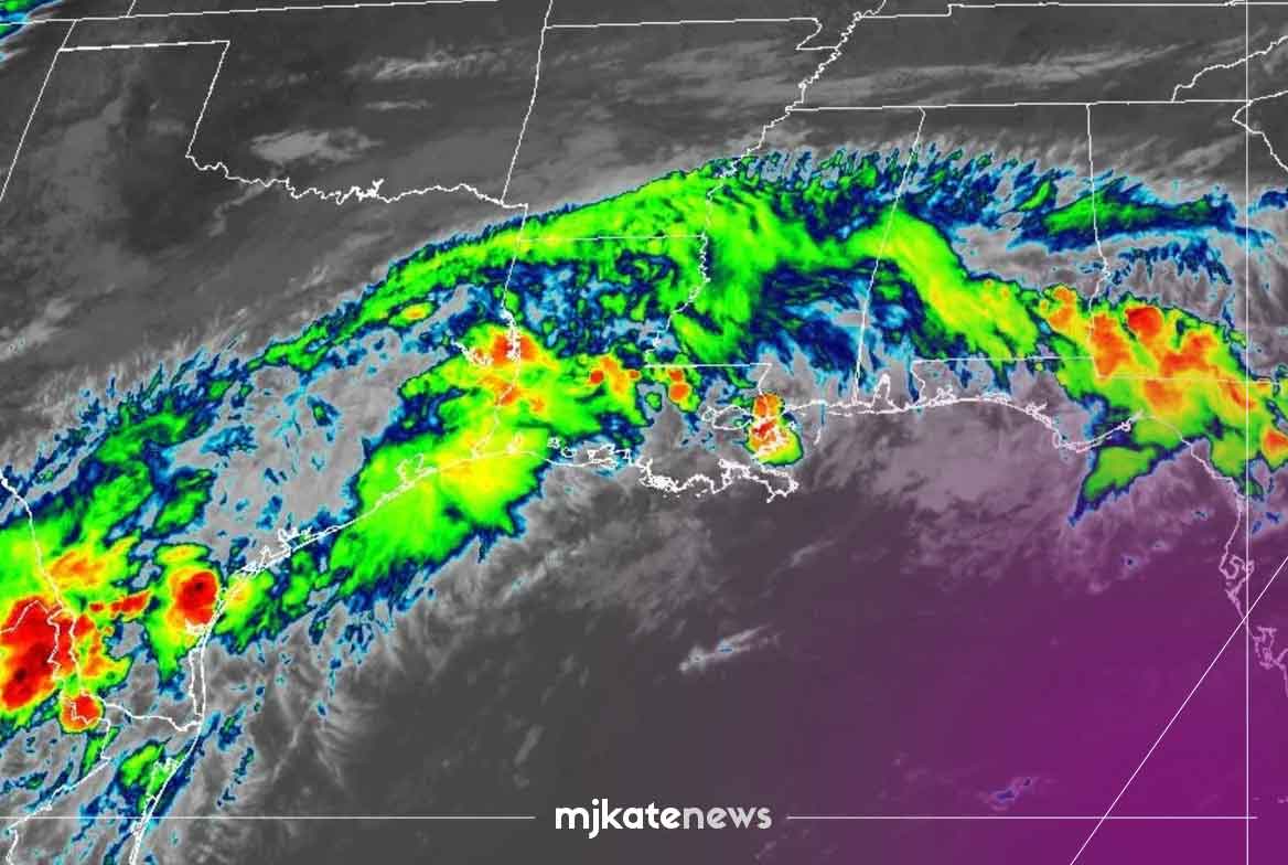

Communities across the Texas Hill Country are grappling with a rapidly deteriorating flood situation this week after a slow-moving tropical weather system parked itself over the region, unleashing extraordinary volumes of rainfall and transforming normally tranquil streams into violent torrents. The National Weather Service has placed multiple counties under extreme alerts, warning that the event could rank among the most disruptive flash flood episodes the area has seen in recent years.
According to federal forecasters, isolated pockets of the Hill Country may accumulate as much as 20 inches of water before the system finally weakens or shifts. Such totals, delivered over a compressed timeframe by a stalled weather pattern, pose a severe threat to life and property. Low-water crossings — a familiar hazard in this part of central Texas — have been overwhelmed, with several rural roads reported washed out and sections of state highways temporarily impassable.
The Hill Country, with its limestone terrain and shallow soils, is notoriously vulnerable to sudden flooding. Rain that might soak into the ground elsewhere instead runs off almost immediately, funneling into narrow canyons and river basins such as the Guadalupe, Blanco, and Pedernales. When tropical moisture stalls, as it has in this case, the result can be a cascade of failures: overwhelmed culverts, stranded motorists, and rising water that reaches homes within minutes rather than hours.
Local officials across Kerr, Bandera, Comal, and surrounding counties have urged residents to avoid travel and to move to higher ground if they live near waterways. Emergency management teams have pre-positioned high-clearance vehicles and swift-water rescue crews, but responders emphasize that the safest action is prevention. “Turn around, don’t drown” has become a repeated refrain on county social media pages, a reminder that most flood fatalities in Texas occur in vehicles attempting to cross flooded roads.
The current crisis stems from a broader meteorological setup common during the peak of the Atlantic hurricane season. A weakened tropical cyclone or remnant low, rather than pushing inland and dissipating, has become trapped by stagnant upper-level winds. Without a steering current to push it along, the system continues to draw warm, moist air from the Gulf of Mexico and recycle it over the same communities. Forecasters describe this as a “training” effect, where rain bands repeatedly march over identical locations like cars on a train track.
Beyond the immediate danger to drivers and hillside residents, the flooding raises concerns about infrastructure. Small dams and stock tanks built across the region are under stress, and agricultural operations face losses from submerged pastures and washed-out fences. In tourist-dependent towns, where summer visitors flock to rivers and dance halls, closures have disrupted local economies just as the season reaches its height.
State agencies have been monitoring the situation in coordination with the Weather Service. While no federal disaster declaration has been announced solely on the basis of the current alerts, officials note that prolonged saturation could lead to river flooding well downstream, affecting population centers nearer the coast if the runoff consolidates. Reservoirs operated by river authorities are managing releases carefully to balance flood control with future water supply needs, a perennial challenge in a state accustomed to swinging between drought and deluge.
Meteorologists caution that predicting the exact footprint of extreme rainfall remains difficult. A shift of just a few dozen miles in the storm’s stagnant center can mean the difference between a manageable event and a catastrophe. As of the latest advisories, the heaviest rain signal continues to target the Hill Country through the midweek, with gradual improvement expected only as the upper-level pattern finally begins to progress.
For now, residents are left to watch rising creeks and wait out a system that shows little mercy. The episode serves as a stark illustration of how a single stalled storm can upend daily life across a landscape ill-equipped to absorb such sudden abundance. Preparedness, officials say, remains the only reliable defense against water that gives no warning beyond the sound of its own approach.